
This is in continuation of our previous two blogs Understanding West Bengal politics The Partition – 1905 and the Reunification – 1911 & Understanding West Bengal politics Partition in 1947 – West Bengal and East Pakistan . We mentioned in our
previous blog that in this blog we will look into the unresolved border related
problem. Let us look into it.


Partition has long been used as a tool of
resolving ethnic and communal problems. It got wide recognition after the
Second World War and more predominantly during the Cold War regime. The
Partition of Germany, Korea, and Vietnam are some of the examples of
territorial partition. The Partition of the British Indian Empire followed the
same custom. The partition academics have argued that physical separation of
warring ethnic groups may be the only possible solution to civil war. However
this argument has recently been severely criticized by a group of scholars particularly
after the dissolution of the Soviet Union and the resurgence of ethnic violence
in different parts of the world. Since this debate is not our subject of
discussion, we will rather skip it and move on to our subject of Partition of
Bengal.
The Partition of Bengal as a part of larger
project of the Partition of the British Indian Empire reveals some interesting
features and also challenges. By the end of 1946 it became almost evident in
political circle that the Partition of the British Empire was inevitable. The ‘Undivided
Sovereign Bengal Plan’ launched by SaratBasu in cooperation with AbulHasim
and Suhrawandy failed to make an impact in the Bengali minds. The public
opinion was shaped profoundly by the terrors of communal riots. The Hindu
Mahasabha and the Congress wanted speedy partition of the province and launched
a determined movement in favor of it. At the all India level Congress and
Muslim League decided a ‘peaceful transfer of power’ at the cost of Partition.
When Lord Mountbatten announced his Partition Plan, popularly known as 3rd June
Plan, neither Muslim League nor Congress opposed it.
The Bengal Boundary commission was formed on 30
June 1947. The members appointed in the Commission were Justice Bijan Kumar
Mukherjea, Justice C.C. Biswas, Justice Abu Saleh Mohamad Akram and Justice S.A.
Rahaman. Sir Cyril Radcliffe was appointed as the Chairman of the Commission.
The Boundary Commission was ‘instructed to demarcate the boundaries of the
two parts of Bengal on the basis of ascertaining the contiguous areas of
Muslims and non-Muslims. In doing so, it will also take into account other
factors’. It was also instructed to complete the report before 15 August.
After preliminary meetings, the commission invited the submission of memoranda
and representations by interested parties. A large number of memoranda and
representations were received. The public sitting of the Commission took place
in Calcutta between 16 July and 24 July at a stretch including Sunday, 20 July 1947.
Arguments were presented to the Commission by numerous parties on both sides.
However, the main cases were presented by counsel on behalf of the Indian
National Congress, the Bengal Provincial Hindu Mahasabha, the New Bengal
Association and the Muslim League. As Radcliffe acted as the Chairman of the
Punjab Boundary Commission simultaneously, he did not attend the public
sittings in person. After the close of the time of public sittings, the
Commission devoted it’s time for clarification and discussion of the issues
involved. The discussion took place in Calcutta.
Time
Schedule of the Bengal Boundary Commission
03 June 1947:
Announce of the Mounbatten Plan
30 June 1947:
Constitution of the Bengal Boundary Commission with Radcliffe as the chairman
08 July 1947:
Radcliffe arrived in Delhi and met the Indian leaders
16-24 July
1947: Public sittings of the Commission held in Calcutta
13 August
1947: Radcliffe submitted the Report
17 August 1947: The Award was announced
publicly
The
Radcliffe Award was published on 17 August 1947 two days after the Independence
after much speculation. It drew a dividing line between the two parts of
Bengal.
1. To East
Pakistan was assigned the whole of the Chittagong and Dacca Division comprising
seven districts; the whole of the Rangpur, Bogra, Rajshahi and Pabna districts
of the Rajshahi Division and the whole of the Khulna district of the Presidency
Division.
2. To West Bengal was assigned the whole of
the Burdwan Division; the districts of Calcutta, the 24 Parganas and
Murshidabad of the Presidency Division and the Darjeeling district of the
Rajshahi Division.
3. The five districts of undivided Bengal viz.
Nadia, Jessore, Dinajpur, Jalpaiguri and Malda were, of course, divided between
West Bengal and East Pakistan.
4. In Nadia districts, twelve Police Stations,
viz. Alamdanga, Bhoiramana, Chandanga, Damurhuda, that part of Daulatpur, east
of the river Mathabhanga, Gangani, Jilannagar, Khoksa, Kumarkhali, Kushtia and
Mirpur were assigned to East Pakistan. These police stations constituted 1352
square miles in area.
5. Jessore
largely remained in East Pakistan. Only two police stations of the district
viz. Bongaon and Gaighata were added to 24 Parganas district of West Bengal
which comprised 319.8 square miles in area.
6. In the case of Dinajpur district, ten
police stations were included in West Bengal. They were Banshihari, a part of
Balurghat, (west of the main north-south railway line), Hemtabad, Itahar,
Kaliaganj, Kosmandi, Kumarganj, Rajganj, Sangarampur and Tapan. The remainder
of the district went to East Pakistan.
7. The whole of Jalpaiguri district was
included in West Bengal except five police stations and some enclaves, south of
Cooch Behar State. These five police stations were Bada, Debiganj, Pachagar, Patgram
and Tetulia. They constituted 672 square miles area.
8. In Malda district the following five police
stations were assigned to East Pakistan. They were Bholaghat, Gomastapur,
Nachol, Nawabganj and Shibganj. They accounted for 596 square miles in area.
The remainder of the district came to West Bengal.
9. The whole district of Sylhet was
transformed from the province of Assam to the new province of East Pakistan,
excepting for the four police stations of Patharkandi, Rataleari, Karimganj and
Badanpur. These police stations were inhabited mostly by the Bengali speaking
Hindus.
10. Murshidabad district did not lose to East
Pakistan any entire police station. However, several maujas (village clusters)
of a number of bordering police stations were subject to dispute or in de facto
possession of East Pakistan.
The Award gave West Bengal an area of 28000
square miles, containing a population of 21.19 million people of which nearly
5.3 million (or 29%) were Muslims. East Pakistan got 49000 square miles for a
population of 39.11 million, of which 29.1% (11.4 million) were Hindus. West
Bengal got 36.36% of the land to accommodate some 35.14% of people, while East
Pakistan got 63.6% of land to accommodate 64.85% of
population.
But this Bengal Boundary Commission couldn't
address the below mentioned issues which still have profound effect on politics
of West Bengal.
Indo-Bangladesh Enclave (ছিট মহল)
First order Enclave
After the partition of India in 1947, Rangpur was
joined to East Pakistan, and Koch Bihar was merged in 1949 with
India.India has about 92 enclaves of Bangladesh territory,
and 106 enclaves of India are surrounded by Bangladeshi
soil. 102 of these are first-order
Indian enclaves, while inside the main part of India, 71 of these are
Bangladeshi first-order enclaves. Further inside these enclaves are an
additional 24 second order- or counter-enclaves (21 Bangladeshi, 3 Indian) and
one Indian counter-counter-enclave, called Dahala Khagrabari . They have an
estimated combined population between 50,000 and 100,000. For better
understanding we are providing geographical maps of enclaves of first-order and
of second-order.
Second Order Enclave
According to a popular legend, the enclaves were used as stakes in card or
chess games centuries ago between two regional kings, the Raja of Koch Bihar and
the Maharaja of Rangpur.As far as history records, the little territories were
apparently the result of a confused outcome of a 1713 treaty between the
Kingdom of Koch Bihar and the Mughal Empire. Possibly, the Kingdom and the
Mughals ended a war without determining a single boundary for what territories
had been gained or lost.
The desire to "de-enclave" most of the enclaves was manifested in
a 1958 Nehru-Noon agreement for an exchange between India and Pakistan without
considering loss or gain of territory, but the matter then worked into a
Supreme Court case in India and Supreme Court ruled that constitutional
amendment is required to transfer the land. So the ninth amendment was
introduced to facilitate the implementation of the agreement. The amendment
could not be passed due to objection to transfer of southern Berubari
enclave.Due to detoriated relation with Pakistan, the issue remained unsolved.
With that agreement un-ratified, the negotiations had to restart after East
Pakistan became independent as Bangladesh in 1971.
The list of enclaves was prepared in 1997 by both
nations. Two Joint Boundary Working Groups was formed to work out the details
of enclaves in 2001. The joint census was carried out it May 2007. In September
2011, India signed the Additional Protocol for the 1974 Land Boundary Agreement
with Bangladesh. The both nations announced an intention to swap 162 enclaves,
giving residents a choice of nationality. Under the agreement, India will
receive 51 out of the 71 Bangladeshi enclaves (from 51 to 54 of the 74 chitts)
that are inside India proper (7,110.2 acres), while Bangladesh will get from 95
to 101 of the 103 Indian enclaves (111 out of 119 chitts) that are inside
Bangladesh proper (17,160.63 acres). India will also acquire 2777.038 acres adverse
possession areas and transfer 2267.682 acres adverse possession areas to
Bangladesh. According to July 2010 joint census, there were 14,215 people
residing in Bangladeshi enclaves in India and 37,269 people residing in Indian
enclaves in Bangladesh. Apparently Bangladesh would retain the 4617 acres of
its Dahagram-Angarpota exclave. The Constitution (119th Amendment) Bill, 2013
was introduced to the RajyaSabha, the Upper House of Parliament of India, on 18
December 2013. The parliament panel, Standing Committee on External Affairs,
approved the bill in November 2014.
Problems of the Sharing of River Water
The boundary line demarcated in 1947 defied all logic of geography and
introduced a new dimension in the South Asian region, ‘hydro-politics’ or
conflict over water. The Partition of the Sub continent created a severe
problem in the management of river water. While in 1960, the Indus water
sharing problem was resolved after prolonged negotiation between the two states
in mediation of the World Bank, the Ganges river water problem remained
unresolved till today.
The Ganges river dispute has been regarded as one of the long lasting and
most interesting international water disputes. The river flows down from the
Himalayan Nanda Devi range and flows for over 92% of its course within India,
before merging with the Brahmaputra and Meghna rivers in Bangladesh and then
flowing out into the Bay of Bengal. The Ganges-Brahmaputra-Meghna system is
responsible for the existence of Bangladesh itself which is a delta formed from
systems silt deposits.
The debate originated in 1951 with the publication of the Indian plan of
constructing a barrage at Farakka, 17 kilometers away from the border. The
barrage would reportedly divert 40000 cusecs out of a dry season average flow
of 50,000 cusecs from the Ganges into the Bhagirathi-Hooghly tributary, to
provide silt-free flow into Calcutta Bay, which would improve navigability for
the city's port during dry months and keep saltwater from the city's water
supply. The Pakistani government officially attracted the attention of the
Indian government about the plan. On 8 March 1952, the Indian government
replied that the project was only under preliminary investigation. Over the
next years, Pakistan occasionally responded to reports of Indian plans for
diversion projects of the Ganges, with little Indian response. In 1957, and
again in 1958, Pakistan offered a bundle of proposals for the better management
of the river water which was crucial for her survival. India virtually turned
down all the proposals. Later it was agreed that water resources experts of the
two countries would meet to exchange their views.
Thereafter several expert-level meetings between India and Pakistan were
held. In the meantime (1961), India announced the initiation of the
construction of the Farakka Barrage which was completed in 1970. However, water
was not diverted at that time, because the feeder canal to the
Bhagirathi-Hooghly system was not yet completed.
Bangladesh came into being in 1971, and by March 1972, the governments of
India and Bangladesh agreed to establish the Indo-Bangladesh Joint Rivers
Commission, “to develop the waters of the rivers common to the two countries on
a cooperative basis.” After long discussion the two sides agreed that a
mutually acceptable solution to issues around the Ganges would be reached
before operating the Farakka Barrage. On 16 May 1974, the prime ministers of
India and Bangladesh met in New Delhi and signed on a joint declaration on the
issue. After that the trial operation of the Farakka Barrage started on 16
April 1975. India continued to divert Ganges water after the trial run, without
negotiating a suitable agreement with Bangladesh. Bangladesh lodged a formal
protest against India with the UNO. As a result the Ganges Water Agreement was
signed on 5 November 1977 only for a short term basis. Ultimately in 1996 an
agreement was made between the two countries. The 1996 Agreement undoubtedly
heralded a new chapter in the Indo-Bangladesh relationship. However, the
Agreement had some serious flaws and thus failed to provide a permanent
solution to the Ganges water dispute. The artificially created boundary not
only produced severe tension in the relationship between the two neighboring states
but also grave environmental problems in the subcontinent.
The changing course of the Ganges has posed a serious threat to the Farakka
Barrage itself as well as the future of the people of a large part of Malda and
Murshidabad. The uninterrupted encroachment of the river towards its left bank
may outflank the barrage and open a new course through the present
Kalindi-Mahananda route. The land eroded from the left bank of the Ganges in
Malda is more than 200 sq.km; while that in Murshidabad is about 356 sq.km.
Millions of rupees are wasted every year in bank protection. The rehabilitation
of the erosion-victims is a serious problem to the state government.
Border Clashes
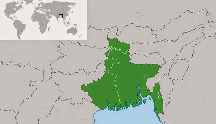
The Indo-Bangladesh (previously East Pakistan) border is the longest land
border which India has with any of its neighbors. The hastily created border did not bother about
the basic norms of boundary making. Naturally it produced a number of problems.
The incomplete demarcation, existence of a large number of enclaves and adverse
possession made the situation grave in the Bengal borderland. Cyril Radcliffe
botched up the job in the east by drawing a straight line through villages and
rivers, houses and marketplaces. Neither did the Indian members of the
commission at that time, nor did their successors who came to rule the country
later, care to undo the damage by rationally demarcating the border. As a
result, border conflicts continue to plague India and its neighbor Bangladesh.
Initially, the Government of India did not pay much attention to this border,
which was thinly policed, mainly by armed police battalions of Assam and West
Bengal. This state of affairs was not very satisfactory and in 1965, a central
force, the Border Security Force (BSF), replaced the state police. However, the
BSF was never deployed in sufficient strength and the main problems plaguing
this border continue. The result has been the recurrent border clashes between
BSF and Bangladesh Rifles (BDR), each of these being required to protect and
defend a 4,000 km border that is porous along certain stretches, parts of which
keep on changing according to the unpredictable course of the rivers that run
by them, and including a 6.5 km stretch that has not yet been demarcated.
Frequent skirmishes are a regular feature in the Bengal borderland nowadays.
One observer has rightly pointed out “….Cyril Radcliff’s sloppy surgery which
has left behind our subcontinent as a mangled body is still held sacrosanct by
the rulers of India, Pakistan and Bangladesh.Will they ever be exorcise the
ghost of colonialism?”
Life in the Bengal Border
To explain this aspect, firstly we would like to share a short poem byPaul
Muldoon, an Irish poet.
The Boundary Commission
You remember that village where the border ran
Down the middle of the street,
With the butcher and baker in different states?
Today he remarked how a shower of rain
Had stopped so cleanly across Golightly's lane
It might have been a wall of glass
That had toppled over. He stood there, for ages,
To wonder which side, if any, he should be on.
- Paul Muldoon
This short poem reflects on how a political decision can seem utterly
meaningless from a personal point of view (the decision here: to draw a border
in the middle of the street). Not that the person (the ‘he’ in the poem) is
unable to understand the presumably elaborate reasons behind the decision. He
might as well agnise the reasons. Nevertheless, somehow they strike him as
senseless.
The life and culture of the people living in the borderlands is getting
more and more academic attention nowadays. The newly drawn border disturbed the
day to day life of the people living in the border areas. “It separated the
peasant’s homestead from the plot he had sharecropped in the last session and
the peasant-proprietor from his holding. It cut creditors off from debtors;
landlords from tenants.” The Partition badly disturbed the channels of
communication which had developed through centuries. It detached the markets
from the surrounding villages on which they were dependent.Thus, the people
living in the border took up smuggling as their survival strategy.
Partition, though an event almost seven decades old, is still a ridiculous
reality in the border zone.
Hope we could highlight the problems which came up due to partition of
Bengal in 1947 which has huge political impact on West Bengal till date and
mostly are unresolved yet. In our next blog we will look into Indo-Pak War in
1971 and subsequent immigration of Bangladeshi Hindus to India.
References
-
Whyte, Brendan R. (2002). "Waiting for the esquimo: An historical
and documentary study of the Cooch Behar enclaves of India and
Bangladesh". The School of Anthropology, Geography and Environmental
Studies, The University of Melbourne. Retrieved 2011-09-11.
-
EvgenyVinikurov, "Theory of Enclaves" (2005) – Chapter
6: Enclave stories and case studies, page 117: Cooch Behar
-
"India & Bangladesh Land Boundary Agreement". Ministry
of External Affairs Government of India. Retrieved 2015-03-01.
-
The land that maps forgot". The Economist. 15 February
2011.
-
"Bangladesh, India to swap 162 land parcels". AFP. 30 August
2011. Retrieved 30 August 2011.
-
"Hope for Indo-Bangladesh enclaves". NDTV. 12 September 2011.
Retrieved 12 September 2011.
-
"Proposed enclave exchange with Bangladesh will be national loss:
BJP". Daily News. 2013-05-11. Retrieved 2013-08-17.
-
Bagchi, Indrani (2013-08-15). "India-Bangladesh border pact
constitutional amendment bill to be tabled in Parliament next
week". Times of India. Retrieved 2013-08-17.
-
Chakrabarty, Rakhi (2013-08-15). "Mahanta canvassing support to
stall exchange of enclaves bill in Parliament". Times of India.
Retrieved 2013-08-17.
-
"Bangladesh land swap bill tabled in
RajyaSabha". Times of India. 2013-12-19. Retrieved 2013-12-19.
-
SougataMukhopadhyay (7 September 2011). "India-Bangladesh sign
pact on border demarcation". CNN-IBN. Retrieved 2011-09-20.
-
"AGP plea to Modi on land-swap deal". The Telegraph.
2014-05-29. Retrieved 2014-06-19.
-
India (19 December 2014). "Bring bill without delay to ratify
Indo-Bangla Land Boundary Agreement: Panel to House". The Indian
Express. Retrieved 19 December 2014.
-
"Par panel approves bill on Indo-Bangla agreement". Business
Standard. 26 November 2014. Retrieved 19 December 2014.
-
Kundu,
TridipSantapa. Partition as a Means of Conflict Resolution: A Case of the
Bengal Boundary Commission and the Partition of Bengal, 1947: Published in Utkal Historical Research
Journal, Vol.XIX, 2006
Well Documented
ReplyDelete